Tour du Colorado Provençal
Walking/pedestrian
in Rustrel
14.6
km
Loop
Walking/pedestrian
4h
Medium
-
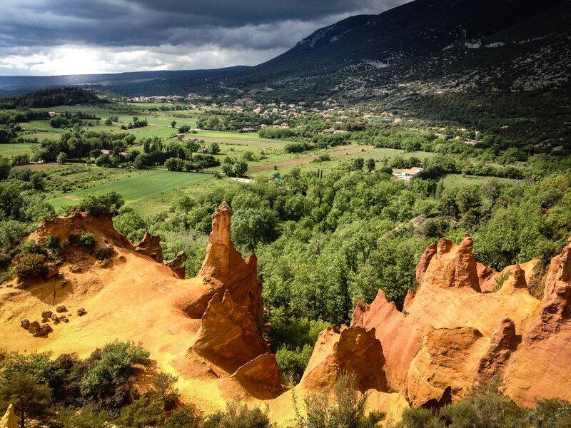
A break in the vast ocher gathering, both intimate and panoramic.
"The ocher massif of Luberon is a geological and landscape curiosity not to be missed! Circling around the heart of the classified site of the Colorado of Rustrel, highly visited, is choosing to enjoy the site differently. Between colored views, sandy passages, mining operation remains and natural wealth, this stroll is a treat! ". says Anne-Camille Vinson - 2nd year of Master's intern at Réseau des Parcs de PACA. -
Find the details of the trail to download on http://www.cheminsdesparcs.fr/
- See all reviews
- 384 meters of difference in height
-
- Start altitude : 410 m
- End altitude : 410 m
- Maximum altitude : 583 m
- Minimum altitude : 329 m
- Total positive elevation : 384 m
- Total negative elevation : -384 m
- Max positive elevation : 62 m
- Min positive elevation : -101 m

Your browser is out-of-date!
Update your browser to view this website correctly. Update my browser now